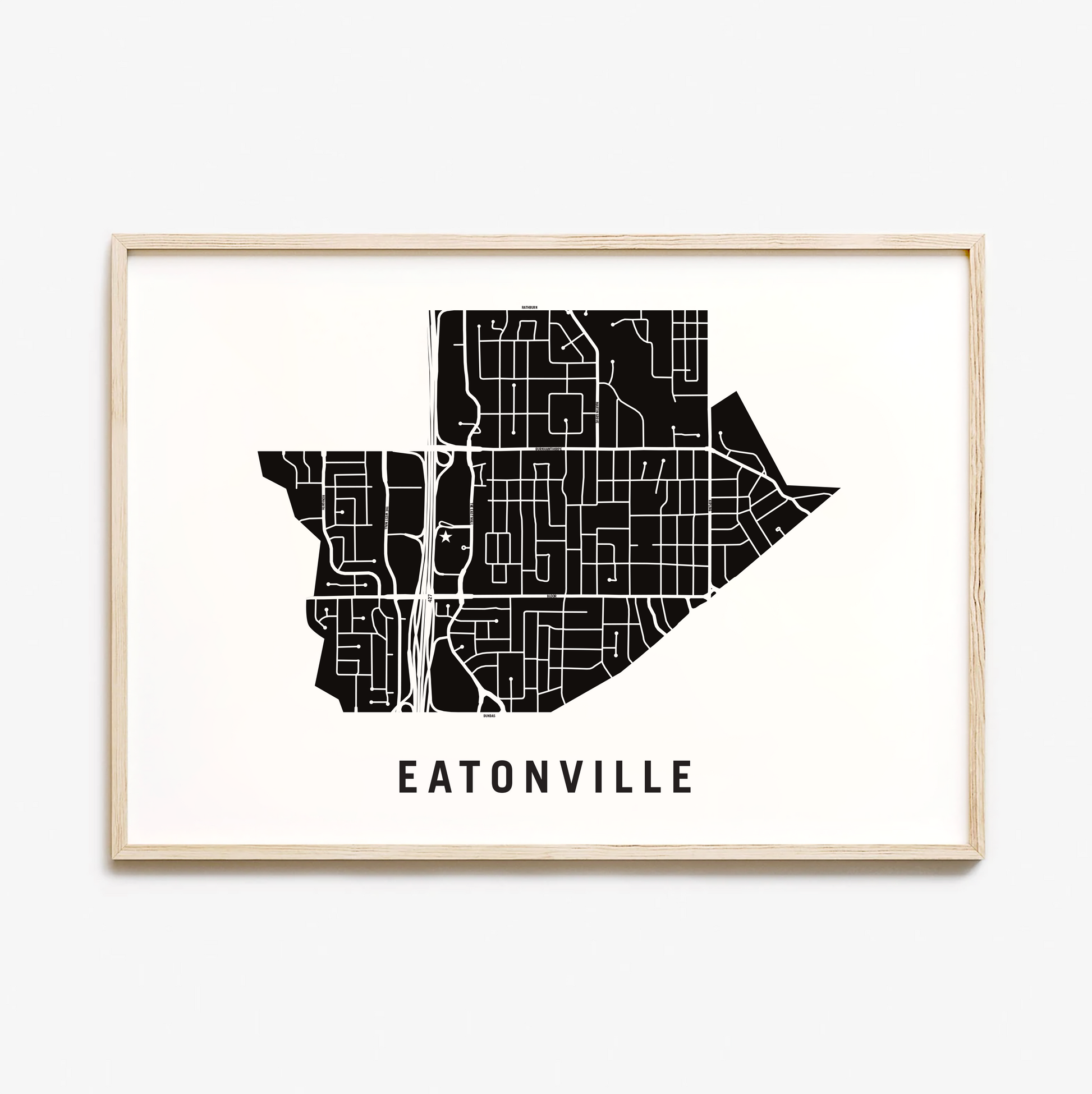

Eatonville Map, Toronto
Eatonville Map, Toronto
Couldn't load pickup availability
Eatonville Neighbourhood
Eatonville began as a farming community in the early 1800’s. One of its first residents was Peter Shaver who donated a portion of his property at Bloor Street and Highway 27 for the local school. This school was affectionately known as the “Swamp School” because of all the frogs that lived in the bushes and marshes nearby.
Peter Shaver’s homestead and adjoining farms were purchased in the 1890’s and early 1900’s by Timothy Eaton the patriarch of Eaton’s Department Store. Eaton donated a portion of his land to the local school which was renamed “Eatonville” in his honour. Eventually this entire area also became known as Eatonville.
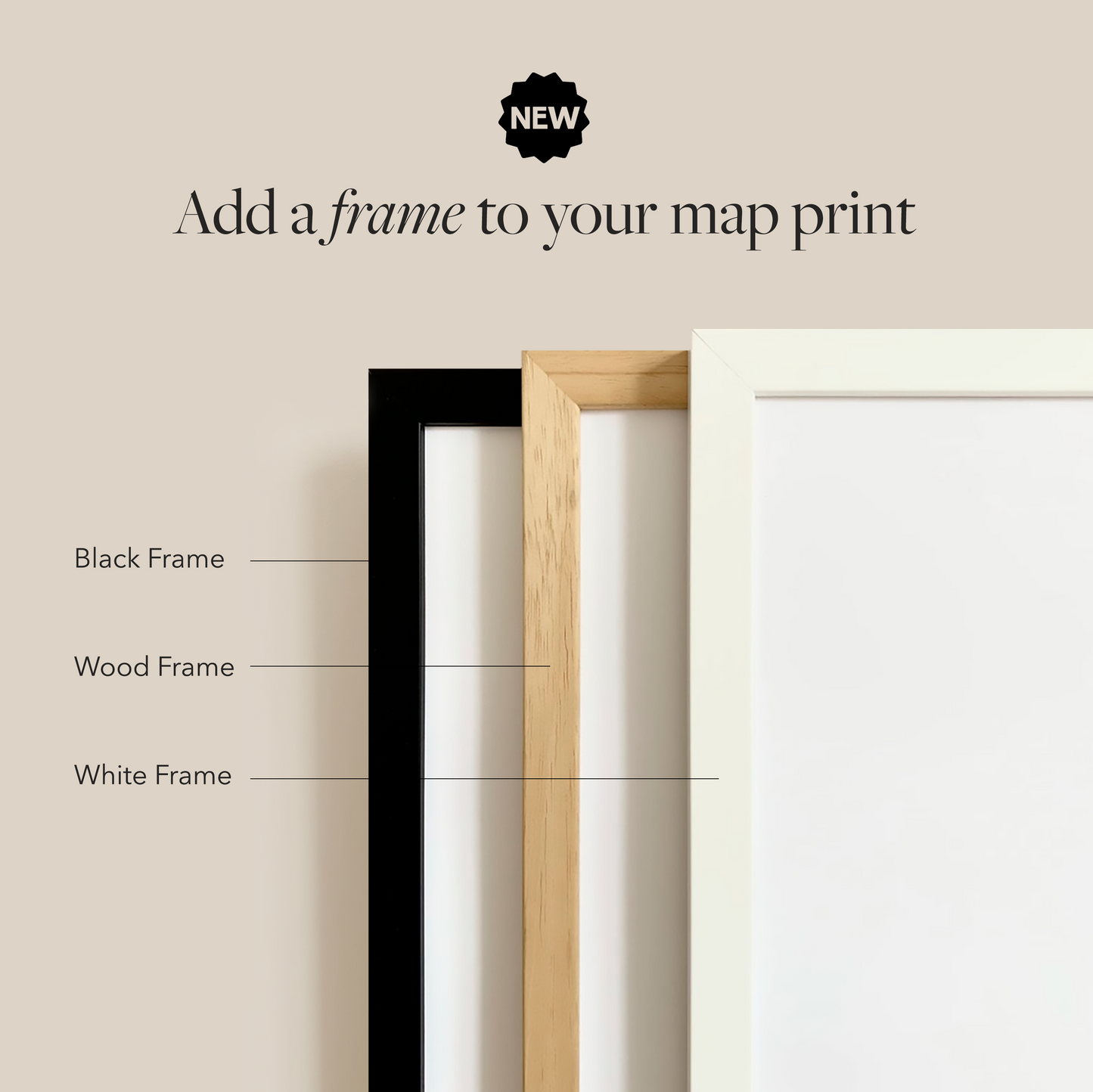
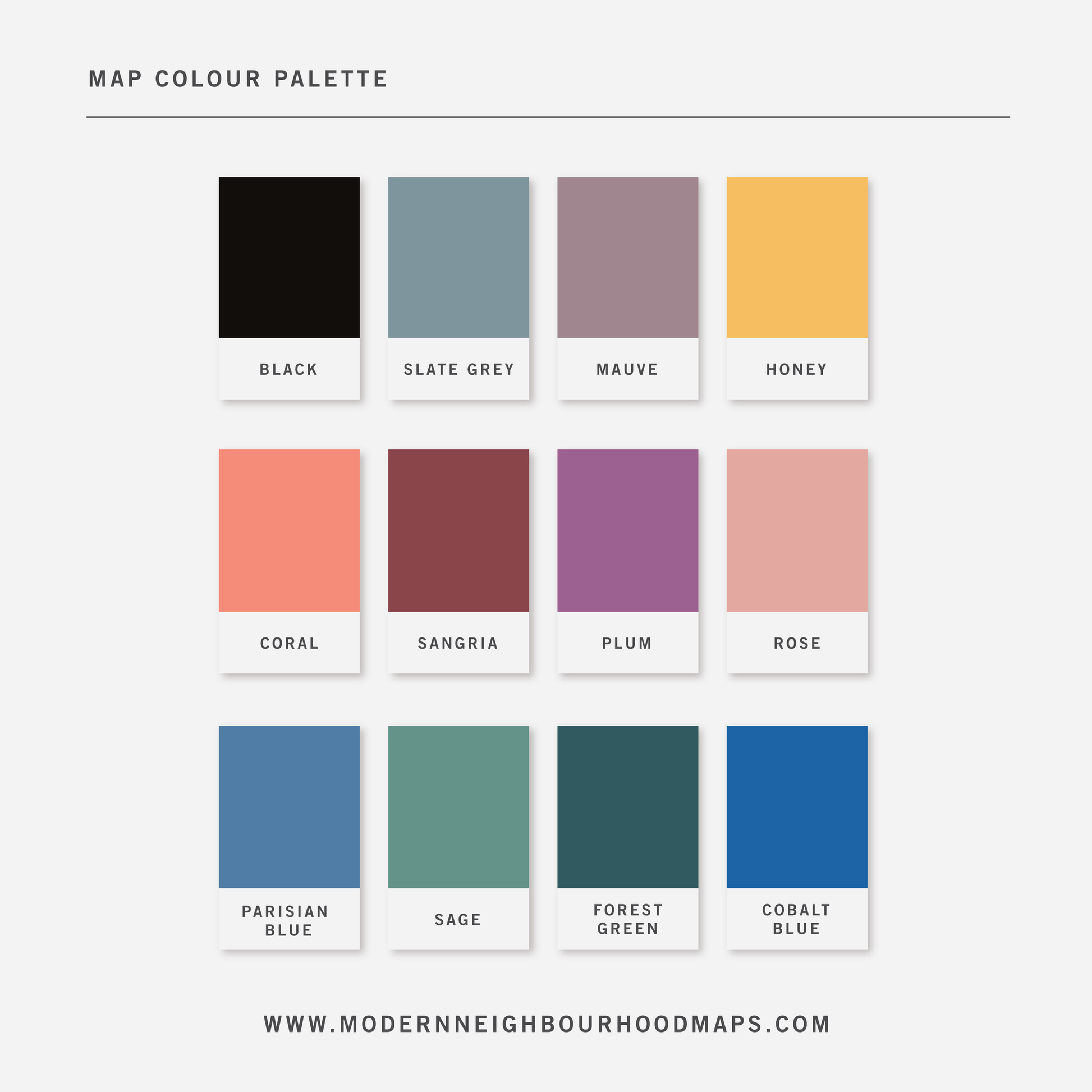
Physical Prints: My prints are uniquely designed, printed on thick, high-quality paper and carefully packaged for delivery. Various colours and custom sized prints available upon request. See colour chart provided. Frame is not included unless added separately.
Customization
Customization
Choose from a wide range of colors, add a heart to your home, or request a custom-sized print. I am happy to personalize your map to make it extra special.
Digital Download
Digital Download
If you choose to purchase a digital print, you will receive a high-resolution PDF file which will give you very clean and sharp prints when printed any size.
At this time, customization of prints (heart on address) are for physical prints only.
Shipping & Delivery
Shipping & Delivery
We offer FREE SHIPPING worldwide!
All our posters are printed on demand in order to ensure great quality, minimize waste, and be environmentally conscious.
All our prints are packaged in 100% recycled cardboard poster tubes or stiff photo envelopes.
Learn more about our shipping policy here.
Our Commitment
Our Commitment
Our map posters are designed and printed locally in Toronto, Ontario, Canada.
They are printed on 190GSM smooth PhotoSatin paper which offers vivid colours and great contrasting blacks.
Our local Canadian print house carefully selects sustainably sourced paper with fiber originating from FSC-certified, longstanding plantations, or from new fiber plantations established on degraded agricultural or pasture lands within Canada.
Their selection of paper from responsible sources are backed with certifications from:
- The Forest Stewardship Council
- The Rainforest Alliance
- The Programme for the Endorsement of Forest Certification
- The Sustainable Forestry Initiative
- The Canadian Standards Association