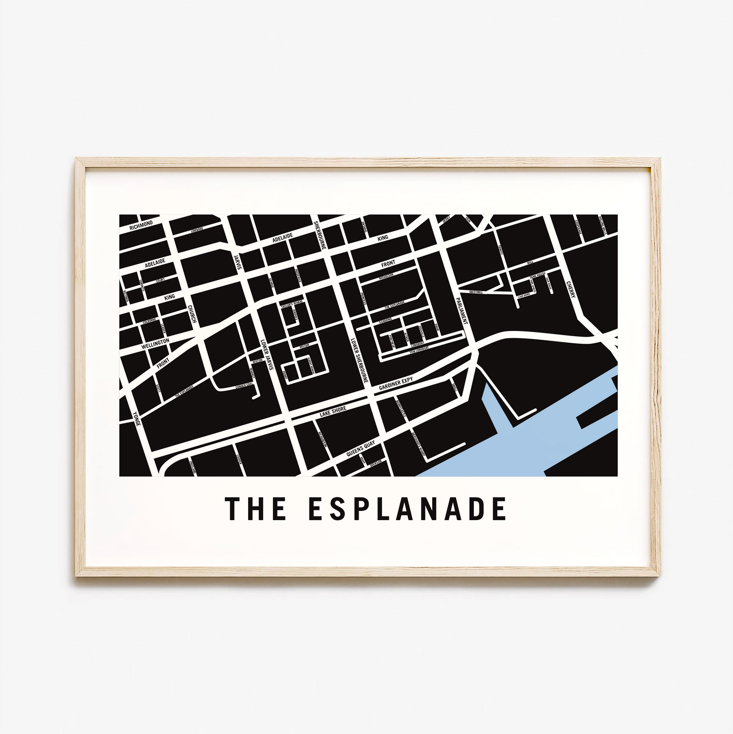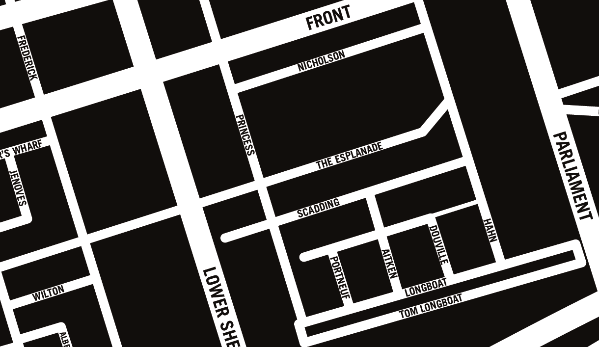
Esplanade Map, Toronto
Esplanade Map, Toronto
Couldn't load pickup availability
The Esplanade Neighbourhood
The Esplanade is an east-west street along the central waterfront of Toronto, Ontario, Canada. Originally conceived as a city beautification project to clean up the city's waterfront in the 1850s, the street was taken over by the coming of the railways to Toronto in 1850. The railway eventually moved to an elevated viaduct, leaving only the eastern section of the street today. The area, east of Yonge Street, was dominated by industrial uses until the second half of the 20th century. As the harbour declined as a transfer point, the railway and industrial uses left the area.
The Esplanade was redeveloped into a residential area, known as the "St. Lawrence Neighbourhood" in the late 1970s and early 1980s. This neighbourhood consists of generally low-rise and mid-rise housing - condominiums, public housing, cooperatives and some town homes between Jarvis and Parliament Streets south of Front Street. In the blocks between Jarvis and Parliament, the southern part of the street (and the former rail tracks) were converted to a long strip of park and recreation space for the residents - David Crombie Park.
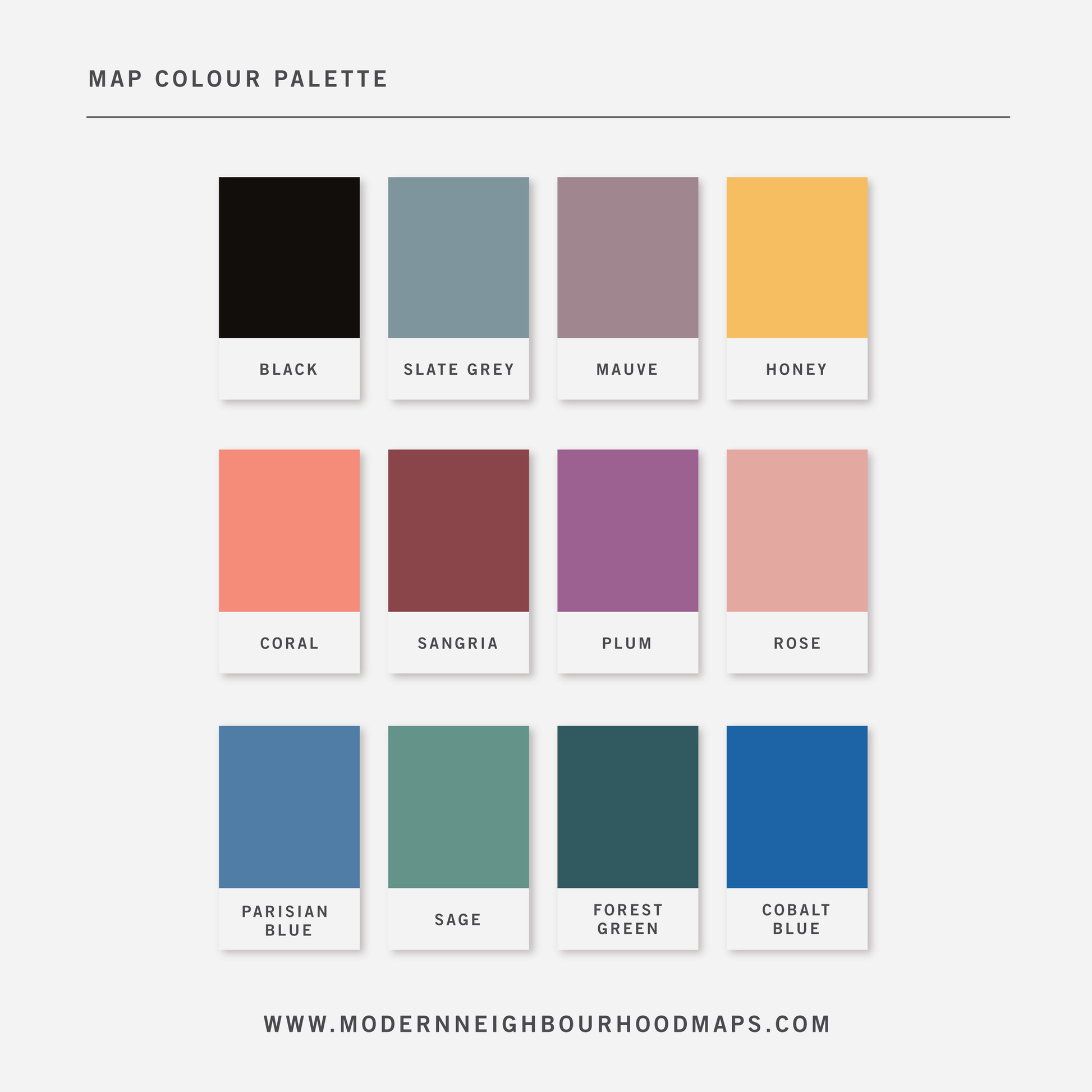
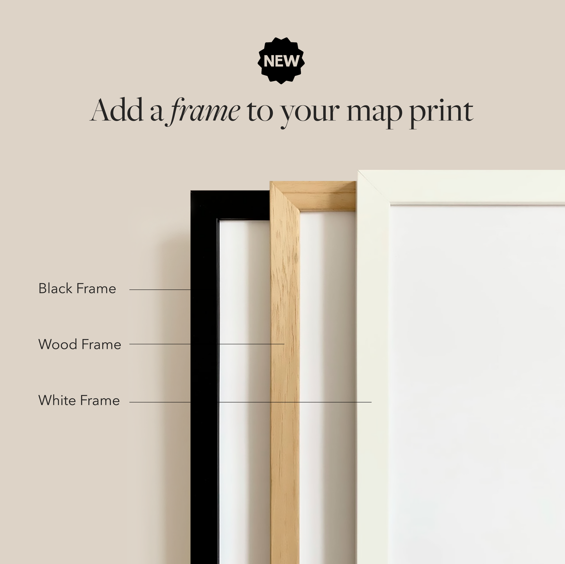
Physical Prints: My prints are uniquely designed, printed on thick, high-quality paper and carefully packaged for delivery. Various colours and custom sized prints available upon request. See colour chart provided. Frame is not included.
Digital Downloads: Each PDF file is high-resolution (300 pixels/inch), which will give you very clean and sharp prints. This is a digital file. No physical items will be sent.
Customization
Customization
Choose from a wide range of colors, add a heart to your home, or request a custom-sized print. I am happy to personalize your map to make it extra special.
Digital Download
Digital Download
If you choose to purchase a digital print, you will receive a high-resolution PDF file which will give you very clean and sharp prints when printed any size.
At this time, customization of prints (heart on address) are for physical prints only.
Shipping & Delivery
Shipping & Delivery
We offer FREE SHIPPING worldwide!
All our posters are printed on demand in order to ensure great quality, minimize waste, and be environmentally conscious.
All our prints are packaged in 100% recycled cardboard poster tubes or stiff photo envelopes.
Learn more about our shipping policy here.
Our Commitment
Our Commitment
Our map posters are designed and printed locally in Toronto, Ontario, Canada.
They are printed on 190GSM smooth PhotoSatin paper which offers vivid colours and great contrasting blacks.
Our local Canadian print house carefully selects sustainably sourced paper with fiber originating from FSC-certified, longstanding plantations, or from new fiber plantations established on degraded agricultural or pasture lands within Canada.
Their selection of paper from responsible sources are backed with certifications from:
- The Forest Stewardship Council
- The Rainforest Alliance
- The Programme for the Endorsement of Forest Certification
- The Sustainable Forestry Initiative
- The Canadian Standards Association