
Hazeldean Map, Edmonton
Hazeldean Map, Edmonton
Couldn't load pickup availability
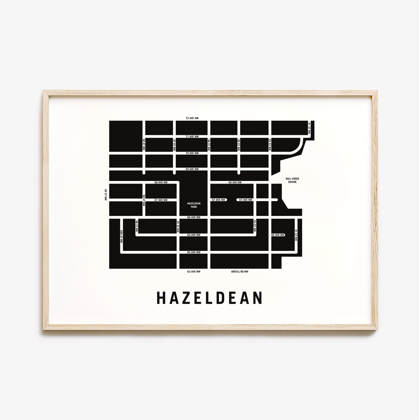
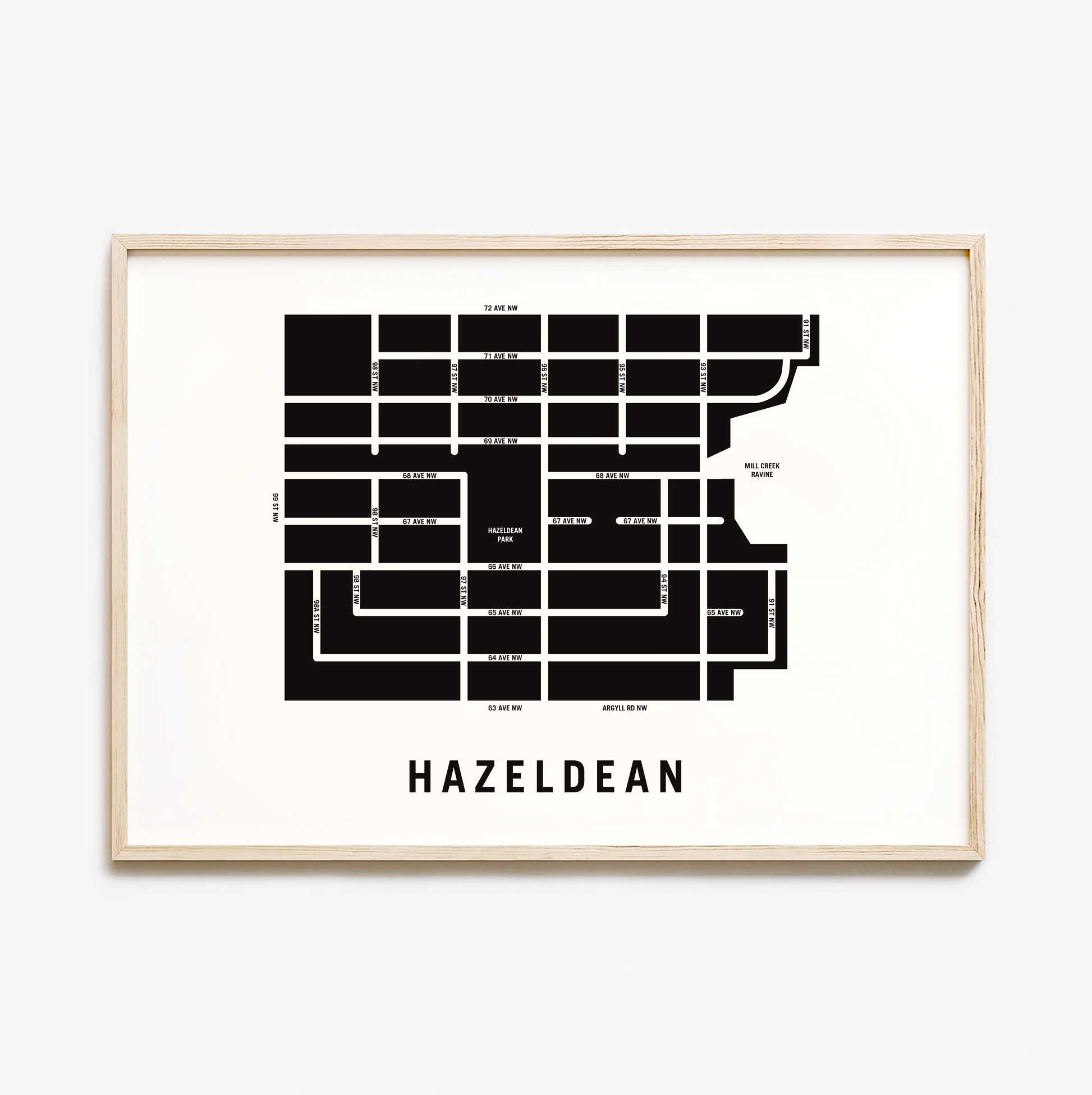
Hazeldean Neighbourhood
Hazeldean is located in an area identified as the land holding of I. Irvine, W. Ogilvie, and C. Anderson by the first river lot and township surveys of the Edmonton Settlement.
In 1902, the Edmonton, Yukon, and Pacific Railroad line crossed from the Calgary and Edmonton Railroad line to Mill Creek Ravine, where it snaked its way to Edmonton via the Low Level Bridge. The tracks have been removed, but the railroad right-of-way remains as a green belt across the neighbourhood.
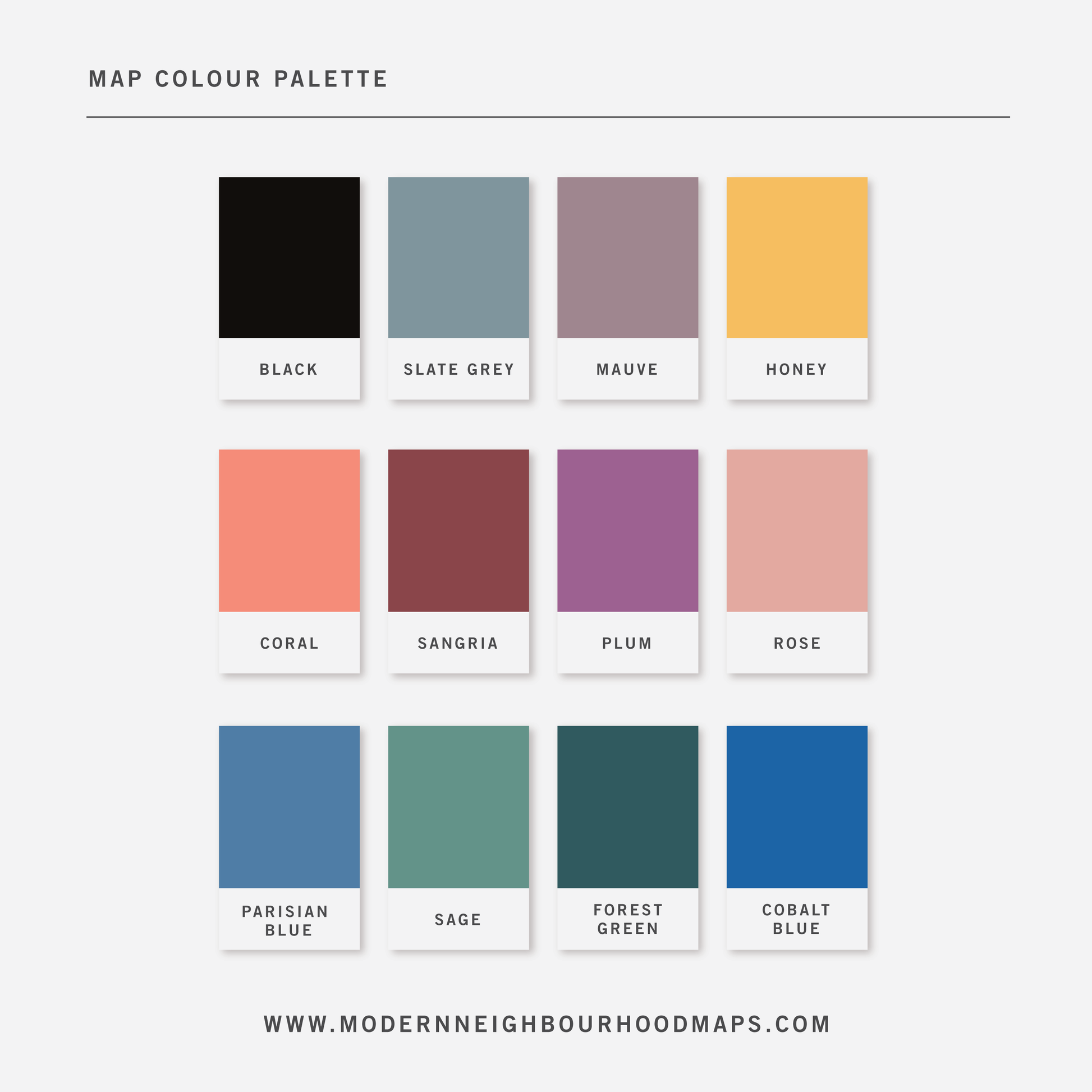
Physical Prints: My prints are uniquely designed, printed on thick, high-quality paper and carefully packaged for delivery. Various colours and custom sized prints available upon request. See colour chart provided. Frame is not included unless added separately.
Customization
Customization
Choose from a wide range of colors, add a heart to your home, or request a custom-sized print. I am happy to personalize your map to make it extra special.
Digital Download
Digital Download
If you choose to purchase a digital print, you will receive a high-resolution PDF file which will give you very clean and sharp prints when printed any size.
At this time, customization of prints (heart on address) are for physical prints only.
Shipping & Delivery
Shipping & Delivery
We offer FREE SHIPPING worldwide!
All our posters are printed on demand in order to ensure great quality, minimize waste, and be environmentally conscious.
All our prints are packaged in 100% recycled cardboard poster tubes or stiff photo envelopes.
Learn more about our shipping policy here.
Our Commitment
Our Commitment
Our map posters are designed and printed locally in Toronto, Ontario, Canada.
They are printed on 190GSM smooth PhotoSatin paper which offers vivid colours and great contrasting blacks.
Our local Canadian print house carefully selects sustainably sourced paper with fiber originating from FSC-certified, longstanding plantations, or from new fiber plantations established on degraded agricultural or pasture lands within Canada.
Their selection of paper from responsible sources are backed with certifications from:
- The Forest Stewardship Council
- The Rainforest Alliance
- The Programme for the Endorsement of Forest Certification
- The Sustainable Forestry Initiative
- The Canadian Standards Association