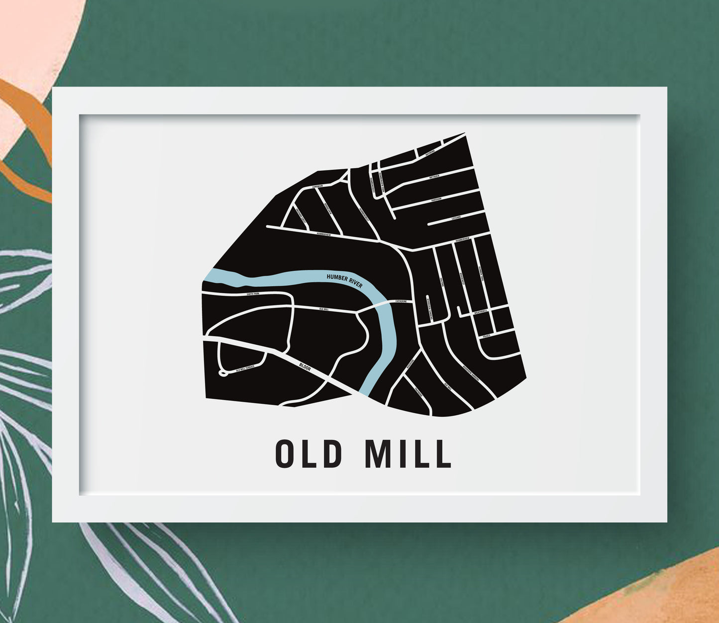
Old Mill Map, Toronto
Old Mill Map, Toronto
Couldn't load pickup availability
The Old Mill Neighbourhood
The historic Old Mill neighbourhood located on the banks of the Humber River was a favourite fishing and hunting spot for people of the First Nations Tribes long before the first European pioneers settled here in the 1790’s.
In 1793 the Kings Mill – the forerunner to todays Old Mill – was built in order to process lumber for the first homes in Toronto – which was then known as the Town of York. A series of fires forced the Mill to be re-built three times. Today the skeletal ruins of the last grist mill also destroyed by fire in 1881, provide the backdrop for the Old Mill restaurant.
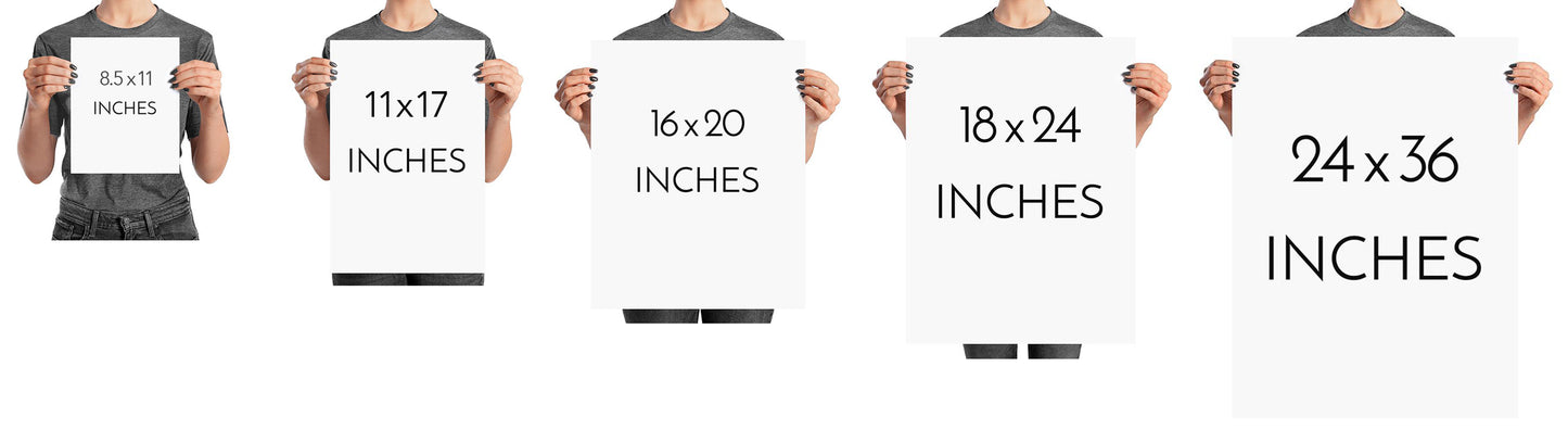
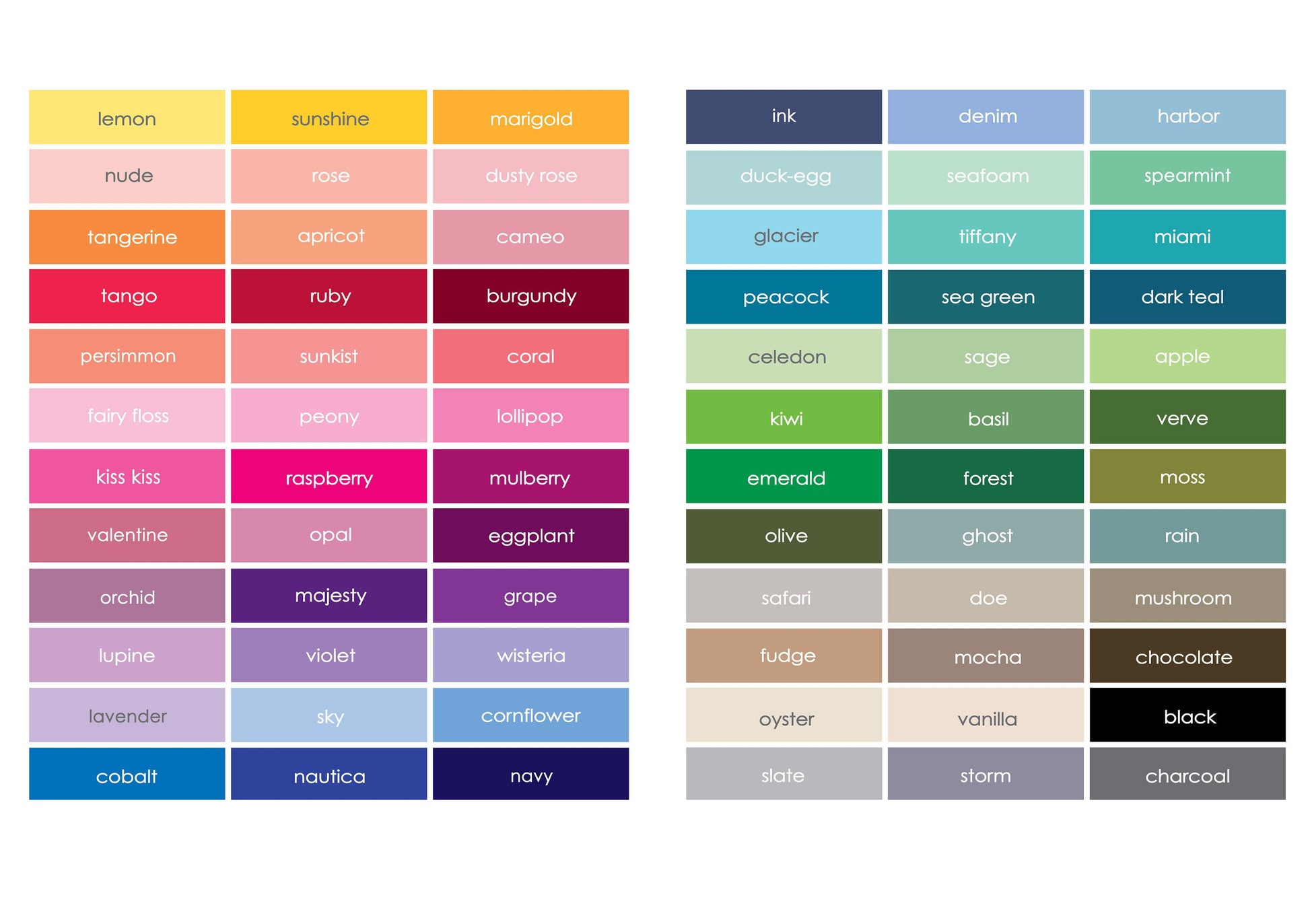
Physical Prints: My prints are uniquely designed, printed on thick, high-quality paper and carefully packaged for delivery. Various colours and custom sized prints available upon request. See colour chart provided. Frame is not included.
Digital Downloads: Each PDF file is high-resolution (300 pixels/inch), which will give you very clean and sharp prints. This is a digital file. No physical items will be sent.
Customization
Customization
Choose from a wide range of colors, add a heart to your home, or request a custom-sized print. I am happy to personalize your map to make it extra special.
Digital Download
Digital Download
If you choose to purchase a digital print, you will receive a high-resolution PDF file which will give you very clean and sharp prints when printed any size.
At this time, customization of prints (heart on address) are for physical prints only.
Shipping & Delivery
Shipping & Delivery
We offer FREE SHIPPING worldwide!
All our posters are printed on demand in order to ensure great quality, minimize waste, and be environmentally conscious.
All our prints are packaged in 100% recycled cardboard poster tubes or stiff photo envelopes.
Learn more about our shipping policy here.
Our Commitment
Our Commitment
Our map posters are designed and printed locally in Toronto, Ontario, Canada.
They are printed on 190GSM smooth PhotoSatin paper which offers vivid colours and great contrasting blacks.
Our local Canadian print house carefully selects sustainably sourced paper with fiber originating from FSC-certified, longstanding plantations, or from new fiber plantations established on degraded agricultural or pasture lands within Canada.
Their selection of paper from responsible sources are backed with certifications from:
- The Forest Stewardship Council
- The Rainforest Alliance
- The Programme for the Endorsement of Forest Certification
- The Sustainable Forestry Initiative
- The Canadian Standards Association