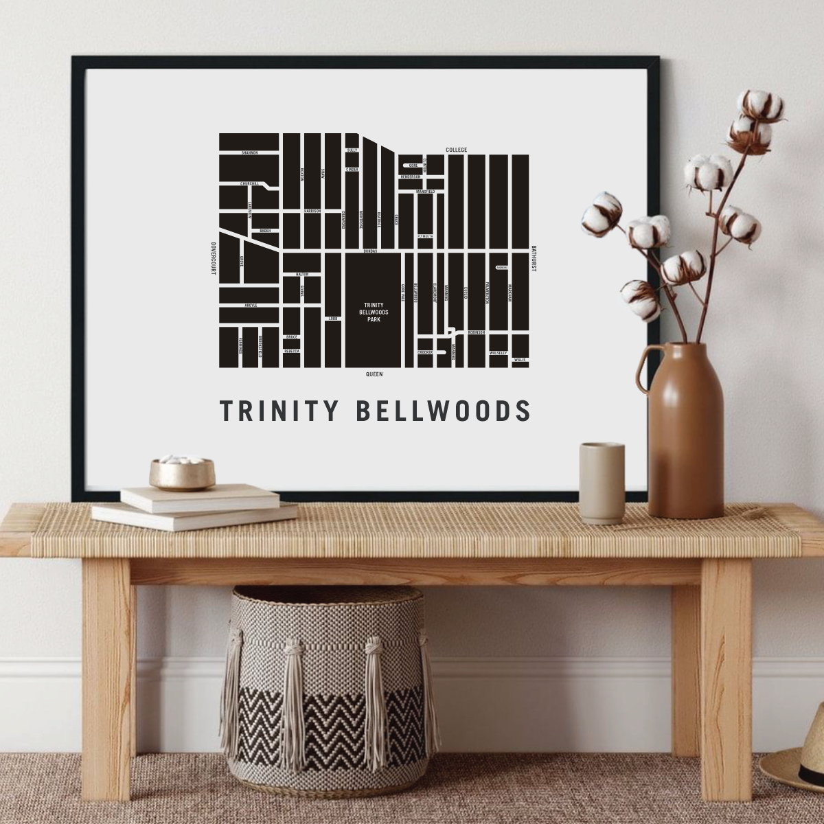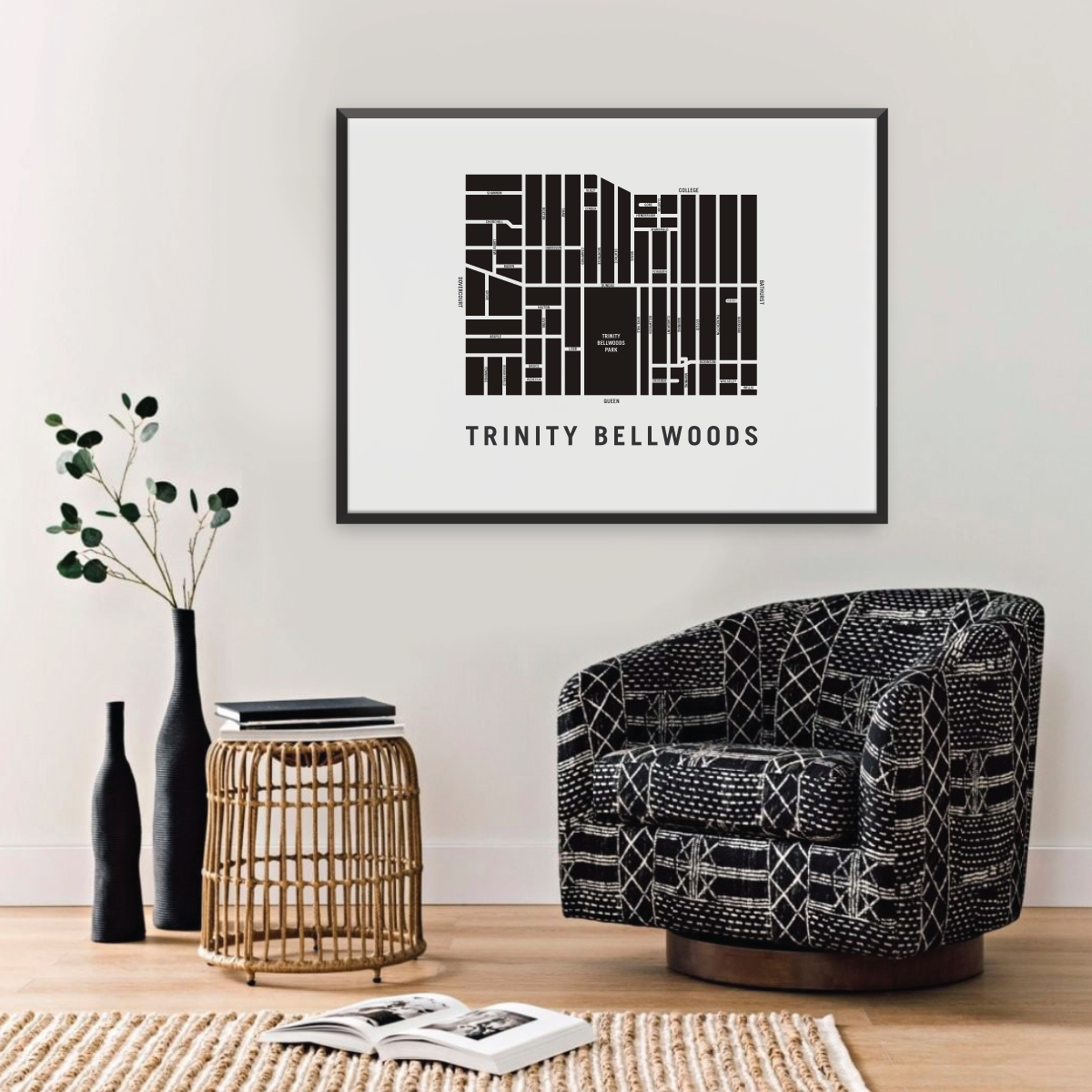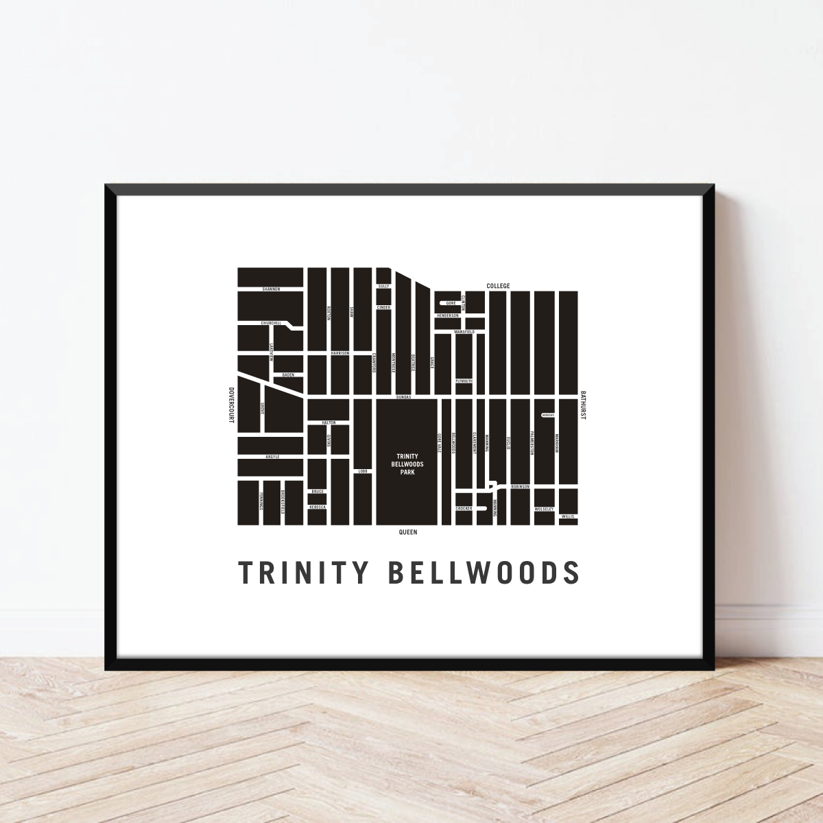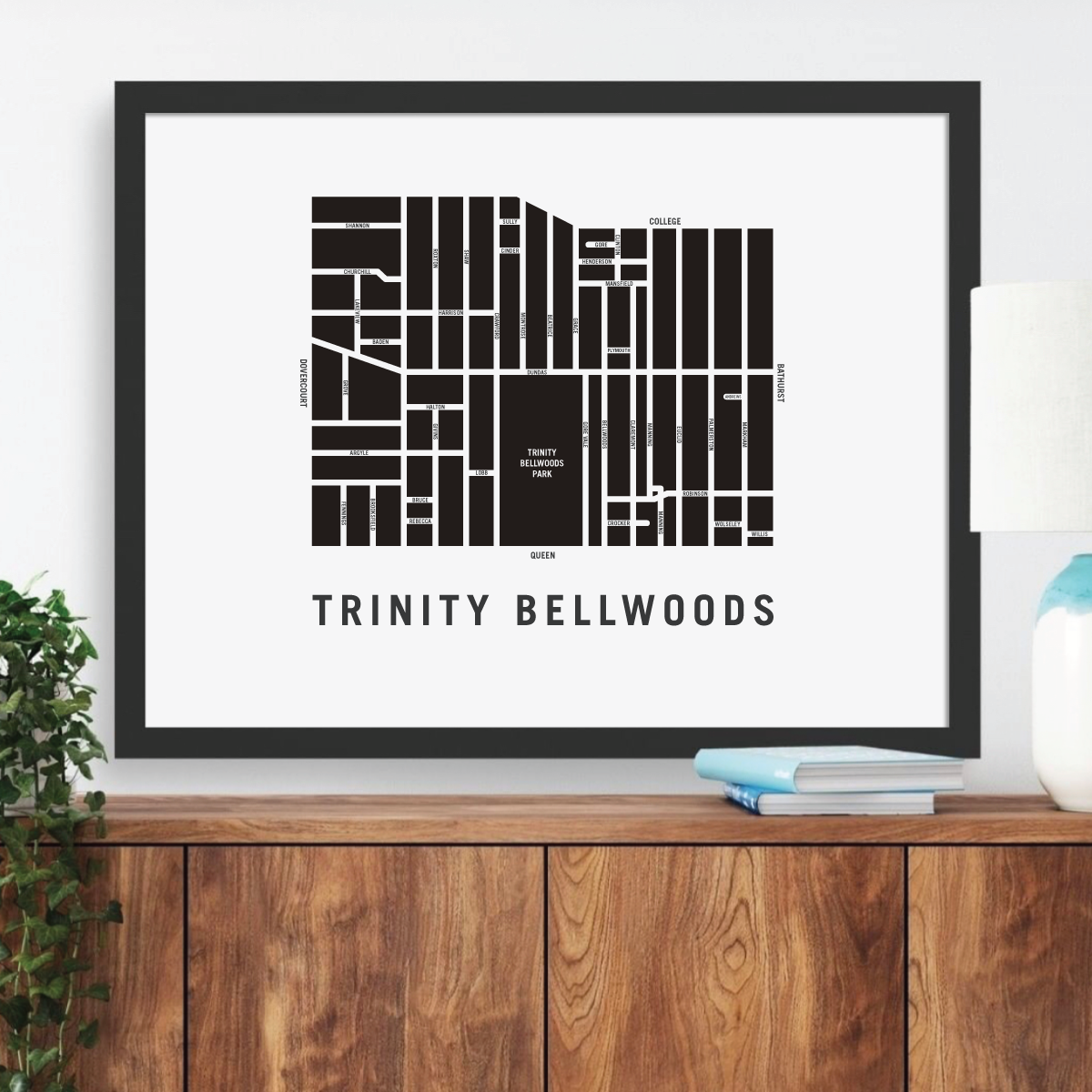
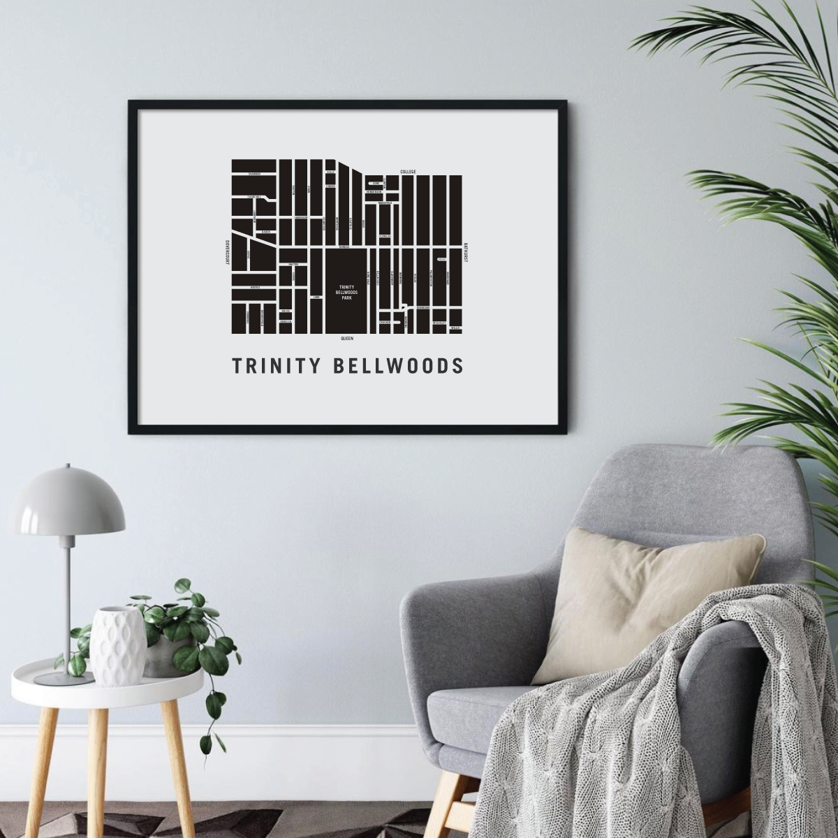

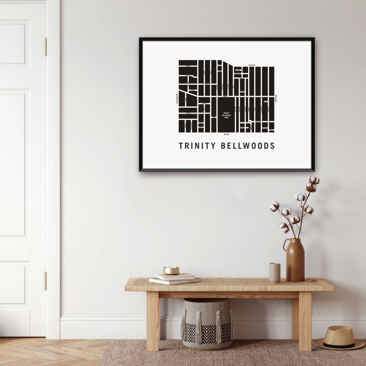

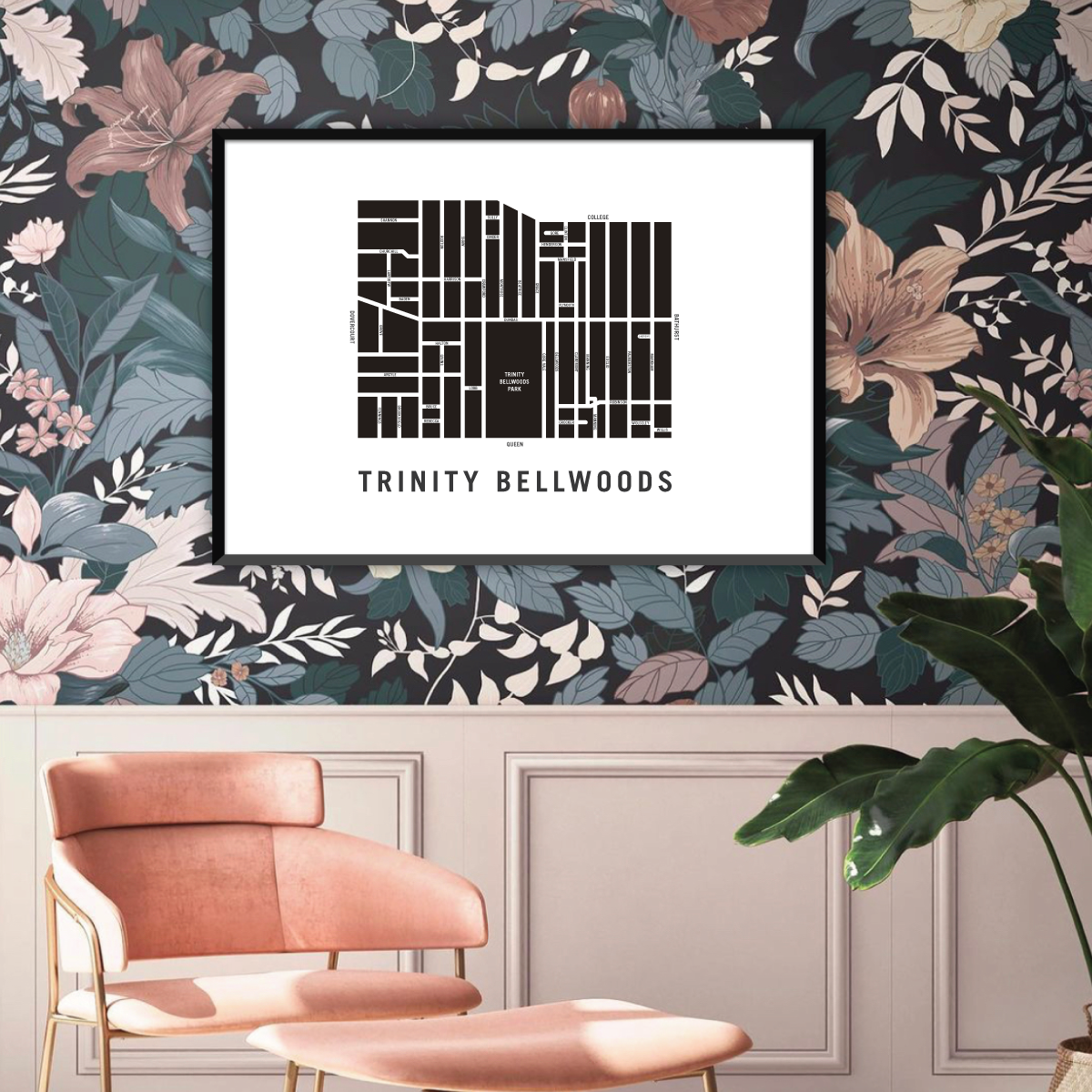
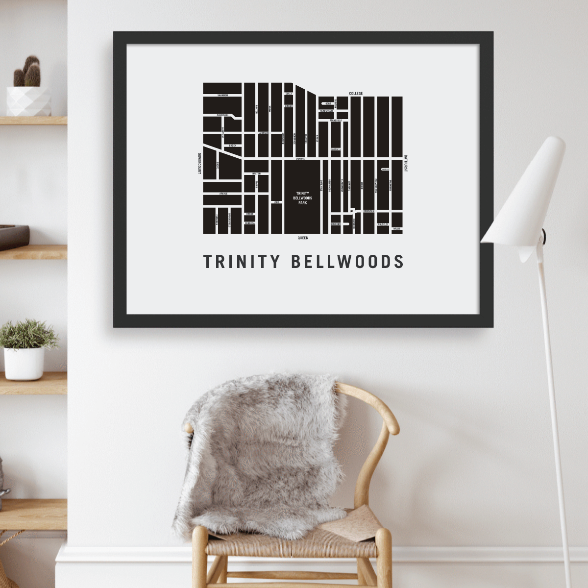
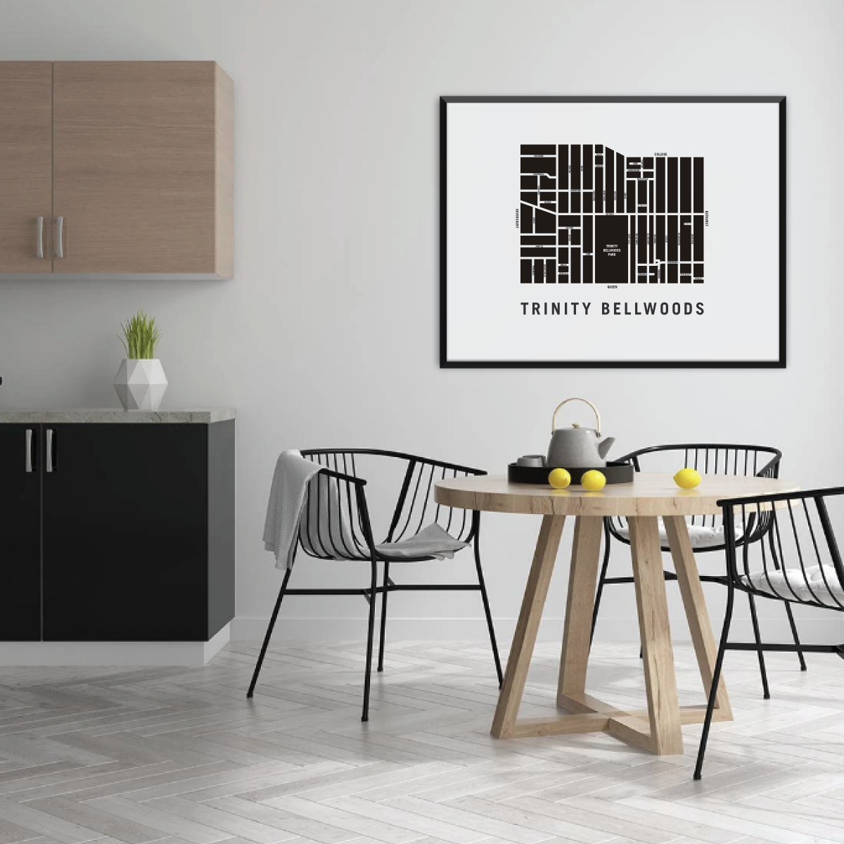

Trinity Bellwoods Map, Toronto
Trinity Bellwoods Map, Toronto
Couldn't load pickup availability
Trinity Bellwoods Neighbourhood
In the early 1800’s, Trinity-Bellwoods was part of a tract of land belonging to Captain Samuel Smith. Smith named his one hundred acre Park Lot ‘Gore Vale’. Gore was in honour of Lieutenant-Governor Francis Gore, and Vale denoted the ravine that is now Trinity-Bellwoods Park.
The lower half of Gore Vale became the grounds of Trinity College, after which this neighbourhood is named. Trinity College was built in 1852, on the site where Trinity-Bellwoods Park is now situated. The entrance gates to Trinity College are still standing at the foot of Queen Street and Strachan Avenue, and serve as a lonely reminder of this once proud institution.
The present day neighbourhood began to take shape in the 1880’s. By the early 1900’s, the Trinity Bellwoods neighbourhood was completely developed.
Trinity Bellwoods neighbourhood map prints make the best housewarming gift for friends and couples. The perfect gift for new homeowners who have just bought their first home. Pay tribute to your favourite neighbourhood or city and customize the map with a heart on your home location.
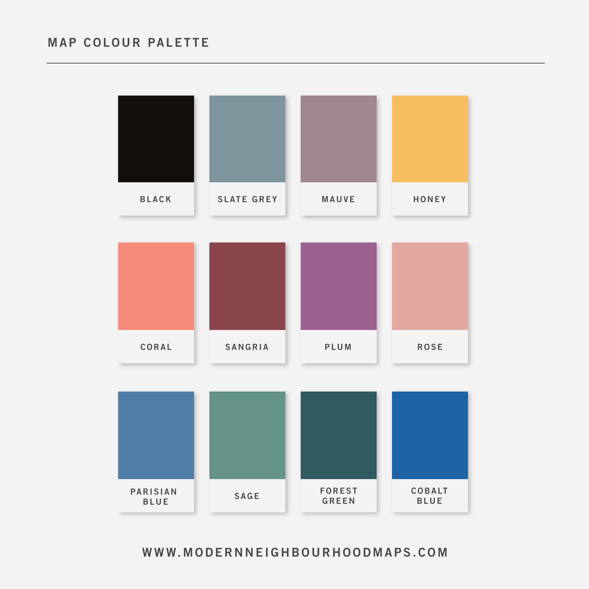
Physical Prints: My prints are uniquely designed, printed on thick, high-quality paper and carefully packaged for delivery. Various colours and custom sized prints available upon request. See colour chart provided. Frame is not included.
Digital Downloads: Each PDF file is high-resolution (300 pixels/inch), which will give you very clean and sharp prints. This is a digital file. No physical items will be sent.
Customization
Customization
Choose from a wide range of colors, add a heart to your home, or request a custom-sized print. I am happy to personalize your map to make it extra special.
Digital Download
Digital Download
If you choose to purchase a digital print, you will receive a high-resolution PDF file which will give you very clean and sharp prints when printed any size.
At this time, customization of prints (heart on address) are for physical prints only.
Shipping & Delivery
Shipping & Delivery
We offer FREE SHIPPING worldwide!
All our posters are printed on demand in order to ensure great quality, minimize waste, and be environmentally conscious.
All our prints are packaged in 100% recycled cardboard poster tubes or stiff photo envelopes.
Learn more about our shipping policy here.
Our Commitment
Our Commitment
Our map posters are designed and printed locally in Toronto, Ontario, Canada.
They are printed on 190GSM smooth PhotoSatin paper which offers vivid colours and great contrasting blacks.
Our local Canadian print house carefully selects sustainably sourced paper with fiber originating from FSC-certified, longstanding plantations, or from new fiber plantations established on degraded agricultural or pasture lands within Canada.
Their selection of paper from responsible sources are backed with certifications from:
- The Forest Stewardship Council
- The Rainforest Alliance
- The Programme for the Endorsement of Forest Certification
- The Sustainable Forestry Initiative
- The Canadian Standards Association